網上版請按此
Pokémon GO driving the Smart City
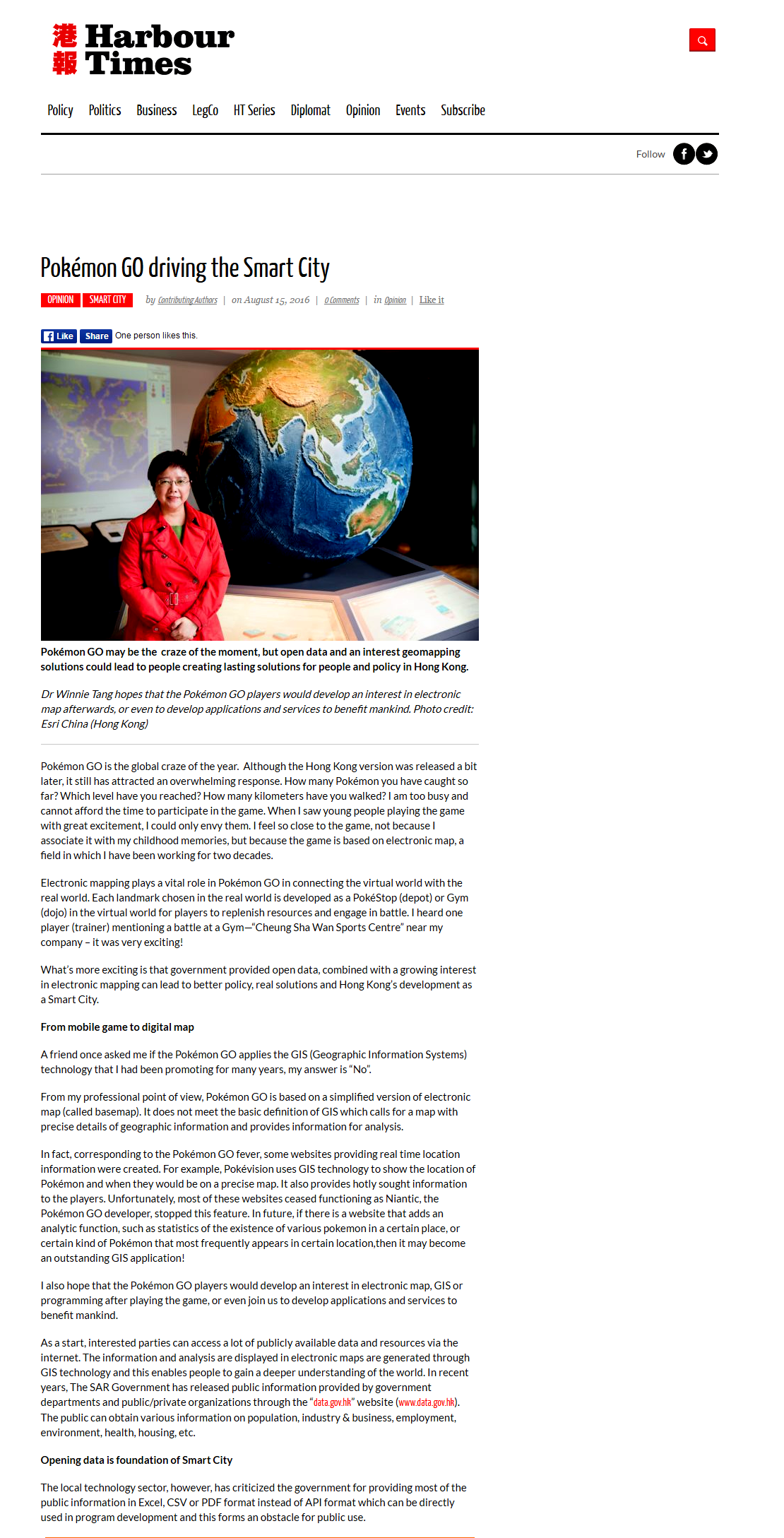
Pokémon GO is the global craze of the year. Although the Hong Kong version was released a bit later, it still has attracted an overwhelming response. How many Pokémon you have caught so far? Which level have you reached? How many kilometers have you walked? I am too busy and cannot afford the time to participate in the game. When I saw young people playing the game with great excitement, I could only envy them. I feel so close to the game, not because I associate it with my childhood memories, but because the game is based on electronic map, a field in which I have been working for two decades.
Electronic mapping plays a vital role in Pokémon GO in connecting the virtual world with the real world. Each landmark chosen in the real world is developed as a PokéStop (depot) or Gym (dojo) in the virtual world for players to replenish resources and engage in battle. I heard one player (trainer) mentioning a battle at a Gym—“Cheung Sha Wan Sports Centre” near my company – it was very exciting!
What’s more exciting is that government provided open data, combined with a growing interest in electronic mapping can lead to better policy, real solutions and Hong Kong's development as a Smart City.
From mobile game to digital map
A friend once asked me if the Pokémon GO applies the GIS (Geographic Information Systems) technology that I had been promoting for many years, my answer is “No”.
From my professional point of view, Pokémon GO is based on a simplified version of electronic map (called basemap). It does not meet the basic definition of GIS which calls for a map with precise details of geographic information and provides information for analysis.
In fact, corresponding to the Pokémon GO fever, some websites providing real time location information were created. For example, Pokévision uses GIS technology to show the location of Pokémon and when they would be on a precise map. It also provides hotly sought information to the players. Unfortunately, most of these websites ceased functioning as Niantic, the Pokémon GO developer, stopped this feature. In future, if there is a website that adds an analytic function, such as statistics of the existence of various pokemon in a certain place, or certain kind of Pokémon that most frequently appears in certain location,then it may become an outstanding GIS application!
I also hope that the Pokémon GO players would develop an interest in electronic map, GIS or programming after playing the game, or even join us to develop applications and services to benefit mankind.
As a start, interested parties can access a lot of publicly available data and resources via the internet. The information and analysis are displayed in electronic maps are generated through GIS technology and this enables people to gain a deeper understanding of the world. In recent years, The SAR Government has released public information provided by government departments and public/private organizations through the “data.gov.hk” website (www.data.gov.hk). The public can obtain various information on population, industry & business, employment, environment, health, housing, etc.
Opening data is foundation of Smart City
The local technology sector, however, has criticized the government for providing most of the public information in Excel, CSV or PDF format instead of API format which can be directly used in program development and this forms an obstacle for public use.
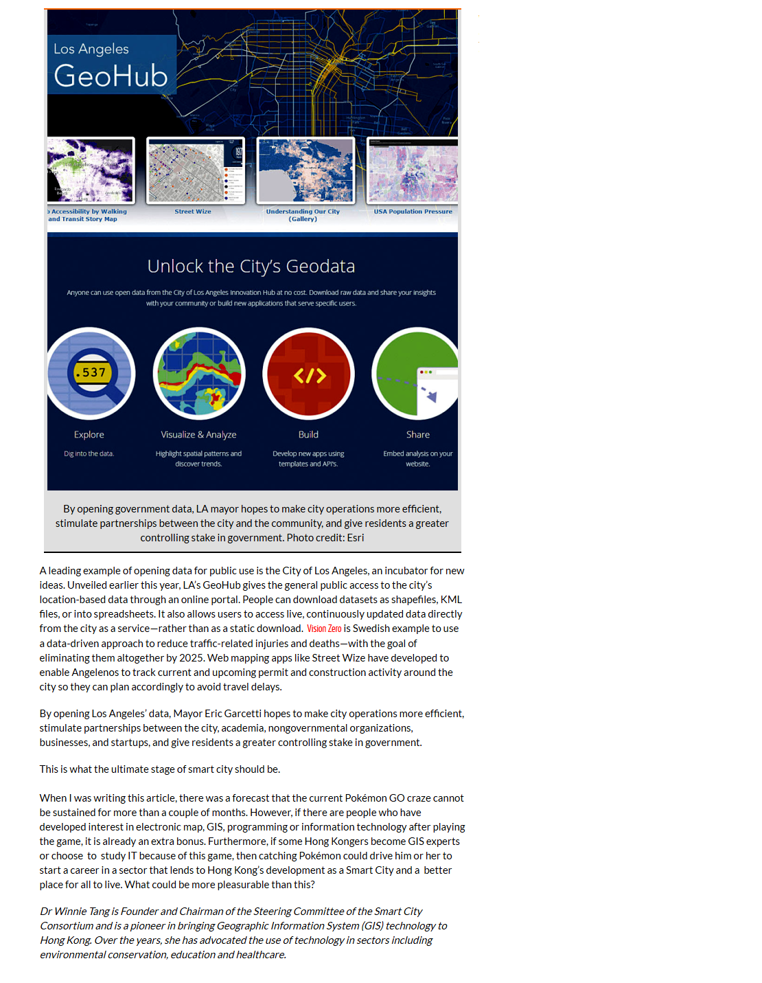
A leading example of opening data for public use is the City of Los Angeles, an incubator for new ideas. Unveiled earlier this year, LA's GeoHub gives the general public access to the city's location-based data through an online portal. People can download datasets as shapefiles, KML files, or into spreadsheets. It also allows users to access live, continuously updated data directly from the city as a service—rather than as a static download. Vision Zero is Swedish example to use a data-driven approach to reduce traffic-related injuries and deaths—with the goal of eliminating them altogether by 2025. Web mapping apps like Street Wize have developed to enable Angelenos to track current and upcoming permit and construction activity around the city so they can plan accordingly to avoid travel delays.
By opening Los Angeles' data, Mayor Eric Garcetti hopes to make city operations more efficient, stimulate partnerships between the city, academia, nongovernmental organizations, businesses, and startups, and give residents a greater controlling stake in government.
This is what the ultimate stage of smart city should be.
When I was writing this article, there was a forecast that the current Pokémon GO craze cannot be sustained for more than a couple of months. However, if there are people who have developed interest in electronic map, GIS, programming or information technology after playing the game, it is already an extra bonus. Furthermore, if some Hong Kongers become GIS experts or choose to study IT because of this game, then catching Pokémon could drive him or her to start a career in a sector that lends to Hong Kong's development as a Smart City and a better place for all to live. What could be more pleasurable than this?
Dr Winnie Tang
Founder and Chairman of the Steering Committee of the Smart City Consortium and is a pioneer in bringing Geographic Information System (GIS) technology to Hong Kong. Over the years, she has advocated the use of technology in sectors including environmental conservation, education and healthcare.