網上版請按此

Startups to improve accessibility and walkability
Smart Mobility generally refers to real-time traffic information or reducing traffic congestion. No wonder Google acquired Waze, an Israeli startup that crowdsources traffic data, for US$1.3 billion in 2013. However, to improve road safety is actually equally important to our daily lives.
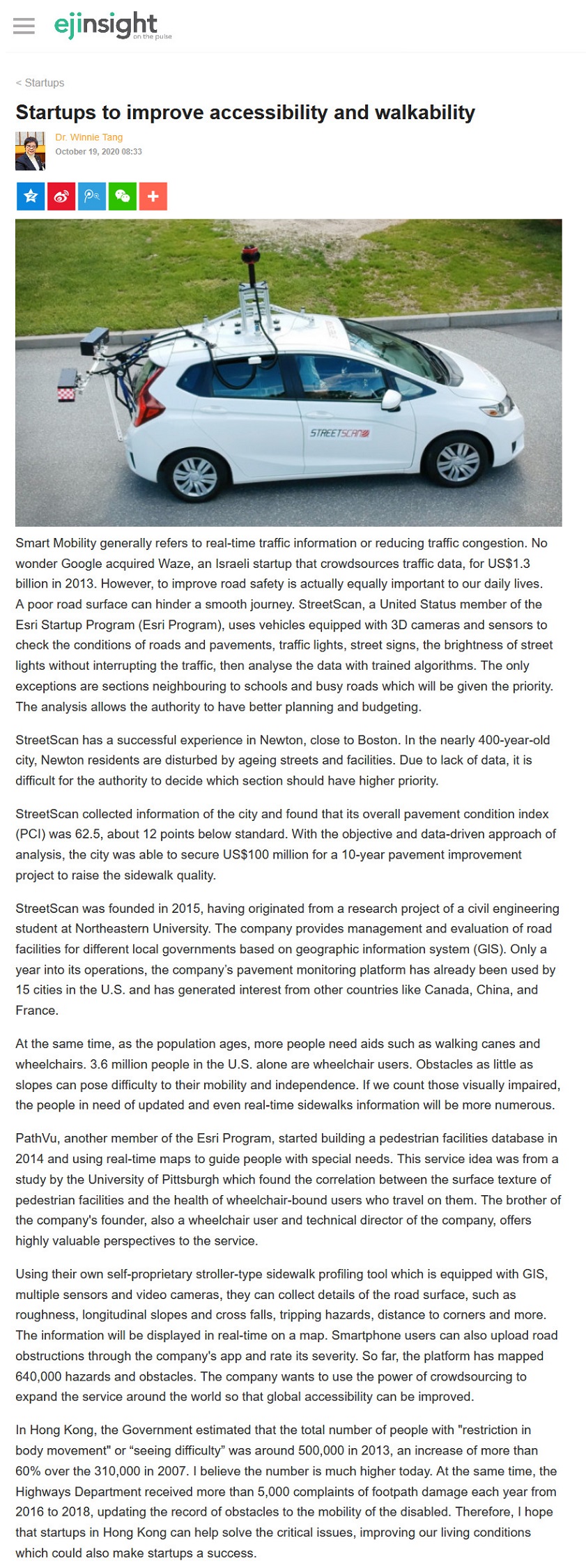
A poor road surface can hinder a smooth journey. StreetScan, a United Status member of the Esri Startup Program (Esri Program), uses vehicles equipped with 3D cameras and sensors to check the conditions of roads and pavements, traffic lights, street signs, the brightness of street lights without interrupting the traffic, then analyse the data with trained algorithms. The only exceptions are sections neighbouring to schools and busy roads which will be given the priority. The analysis allows the authority to have better planning and budgeting.
StreetScan has a successful experience in Newton, close to Boston. In the nearly 400-year-old city, Newton residents are disturbed by ageing streets and facilities. Due to lack of data, it is difficult for the authority to decide which section should have higher priority.
StreetScan collected information of the city and found that its overall pavement condition index (PCI) was 62.5, about 12 points below standard. With the objective and data-driven approach of analysis, the city was able to secure US$100 million for a 10-year pavement improvement project to raise the sidewalk quality.
StreetScan was founded in 2015, having originated from a research project of a civil engineering student at Northeastern University. The company provides management and evaluation of road facilities for different local governments based on geographic information system (GlS). Only a year into its operations, the company's pavement monitoring platform has already been used by 15 cities in the U.S. and has generated interest from other countries like Canada, China, and France.
At the same time, as the population ages, more people need aids such as walking canes and wheelchairs. 3.6 million people in the U.S. alone are wheelchair users. Obstacles as little as slopes can pose difficulty to their mobility and independence. If we count those visually impaired, the people in need of updated and even real-time sidewalks information will be more numerous.
PathVu, another member of the Esri Program, started building a pedestrian facilities database in 2014 and using real-time maps to guide people with special needs. This service idea was from a study by the University of Pittsburgh which found the correlation between the surface texture of pedestrian facilities and the health of wheelchair-bound users who travel on them. The brother of the company's founder, also a wheelchair user and technical director of the company, offers highly valuable perspectives to the service.
Using their own self-proprietary stroller-type sidewalk profiling tool which is equipped with GIS, multiple sensors and video cameras, they can collect details of the road surface, such as roughness, longitudinal slopes and cross falls, tripping hazards, distance to corners and more. The information will be displayed in real-time on a map. Smartphone users can also upload road obstructions through the company's app and rate its severity. So far, the platform has mapped 640,000 hazards and obstacles. The company wants to use the power of crowdsourcing to expand the service around the world so that global accessibility can be improved.
In Hong Kong, the Government estimated that the total number of people with "restriction in body movement" or "seeing difficulty" was around 500,000 in 2013, an increase of more than 60% over the 310,000 in 2007. I believe the number is much higher today. At the same time, the Highways Department received more than 5,000 complaints of footpath damage each year from 2016 to 2018, updating the record of obstacles to the mobility of the disabled. Therefore, I hope that startups in Hong Kong can help solve the critical issues, improving our living conditions which could also make startups a success.
Dr. Winnie Tang
Adjunct Professor, Department of Geography, Faculty of Social Sciences and Faculty of Architecture, The University of Hong Kong