網上版請按此

How to improve new town planning
The Crossrail in London, branded the Elizabeth line, is Europe’s largest infrastructure project in recent years, costing £15 billion, it will start operating in the first half of 2022. Encompassing 42 km of tunnels and 10 new stations, the Crossrail will connect the suburbs with the city center and the Heathrow Airport. One of the major issues of this big project is how to properly manage the huge amount of information up to 12TB, including 2 million computer-aided design (CAD) drawings and models, 8 million documents, 1 million assets, and 50 million geographic information system (GIS) features. The inventory of assets is constantly growing with many programmes of work being carried out simultaneously.
The authority decided to use GIS to record and manage the complex and ever-changing asset list.
Under this huge project, there are many construction sites, and many constraints have to be considered, from monitoring the project progress to avoiding illegal occupation of the site. GIS is strong in data analysis; it is also an information platform that facilitates integration of spatial data from different sources and by various software for sharing among users. At the same time, the authority has established a suite of server-based, desktop, web, mobile and 3D GIS applications to effectively control costs, reduce project delays and overruns, and ensure network security. Its 3D visualization capabilities make it easier to record location of the assets.
According to an article from the Chartered Institute of Logistics and Transport, the online application of GIS greatly reduces the time spent by employees in preparing reports by 80%. For the management, GIS also facilitates communication with external audiences.
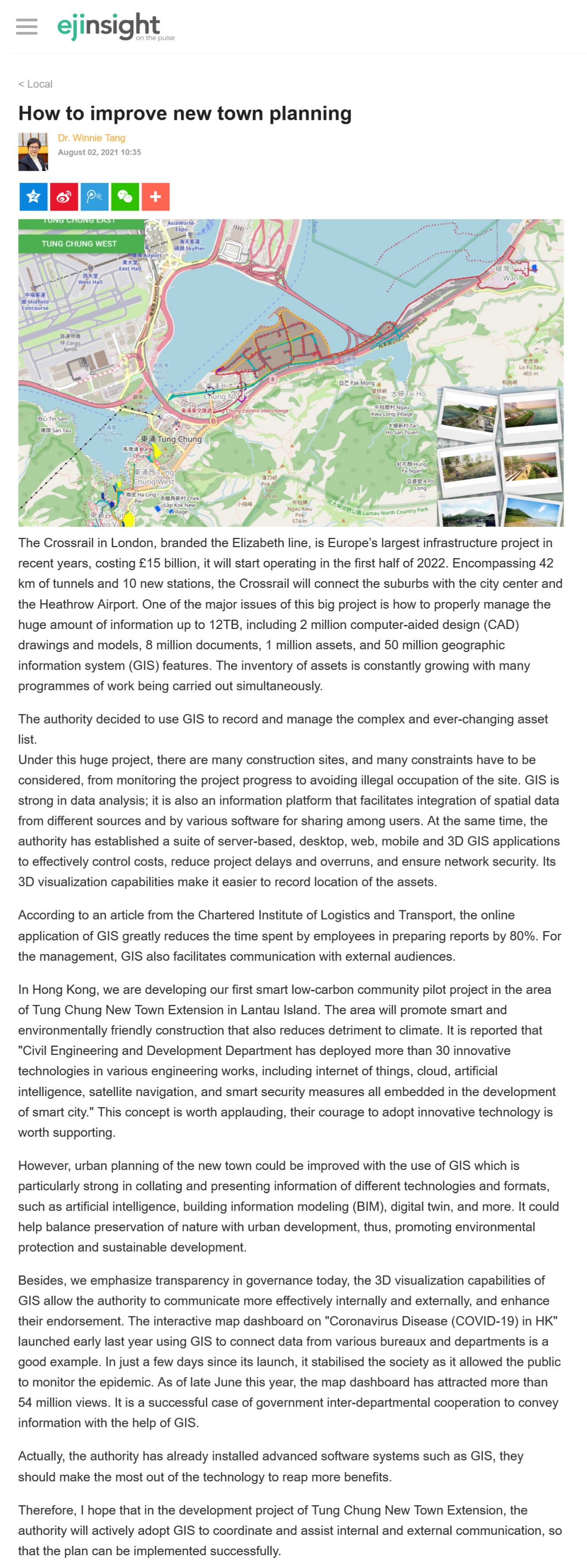
In Hong Kong, we are developing our first smart low-carbon community pilot project in the area of Tung Chung New Town Extension in Lantau Island. The area will promote smart and environmentally friendly construction that also reduces detriment to climate. It is reported that "Civil Engineering and Development Department has deployed more than 30 innovative technologies in various engineering works, including internet of things, cloud, artificial intelligence, satellite navigation, and smart security measures all embedded in the development of smart city." This concept is worth applauding, their courage to adopt innovative technology is worth supporting.
However, urban planning of the new town could be improved with the use of GIS which is particularly strong in collating and presenting information of different technologies and formats, such as artificial intelligence, building information modeling (BIM), digital twin, and more. It could help balance preservation of nature with urban development, thus, promoting environmental protection and sustainable development.
Besides, we emphasize transparency in governance today, the 3D visualization capabilities of GIS allow the authority to communicate more effectively internally and externally, and enhance their endorsement. The interactive map dashboard on "Coronavirus Disease (COVID-19) in HK" launched early last year using GIS to connect data from various bureaux and departments is a good example. In just a few days since its launch, it stabilised the society as it allowed the public to monitor the epidemic. As of late June this year, the map dashboard has attracted more than 54 million views. It is a successful case of government inter-departmental cooperation to convey information with the help of GIS.
Actually, the authority has already installed advanced software systems such as GIS, they should make the most out of the technology to reap more benefits.
Therefore, I hope that in the development project of Tung Chung New Town Extension, the authority will actively adopt GIS to coordinate and assist internal and external communication, so that the plan can be implemented successfully.
Dr. Winnie Tang
Adjunct Professor, Department of Computer Science, Faculty of Engineering; Department of Geography, Faculty of Social Sciences; and Faculty of Architecture, The University of Hong Kong