網上版請按此

Balancing marine conservation and development
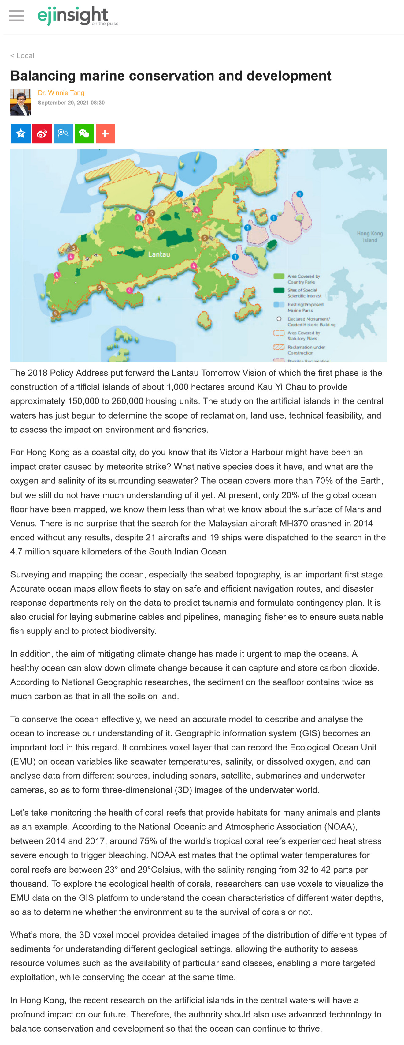
The 2018 Policy Address put forward the Lantau Tomorrow Vision of which the first phase is the construction of artificial islands of about 1,000 hectares around Kau Yi Chau to provide approximately 150,000 to 260,000 housing units. The study on the artificial islands in the central waters has just begun to determine the scope of reclamation, land use, technical feasibility, and to assess the impact on environment and fisheries.
For Hong Kong as a coastal city, do you know that its Victoria Harbour might have been an impact crater caused by meteorite strike? What native species does it have, and what are the oxygen and salinity of its surrounding seawater? The ocean covers more than 70% of the Earth, but we still do not have much understanding of it yet. At present, only 20% of the global ocean floor have been mapped, we know them less than what we know about the surface of Mars and Venus. There is no surprise that the search for the Malaysian aircraft MH370 crashed in 2014 ended without any results, despite 21 aircrafts and 19 ships were dispatched to the search in the 4.7 million square kilometers of the South Indian Ocean.
Surveying and mapping the ocean, especially the seabed topography, is an important first stage. Accurate ocean maps allow fleets to stay on safe and efficient navigation routes, and disaster response departments rely on the data to predict tsunamis and formulate contingency plan. It is also crucial for laying submarine cables and pipelines, managing fisheries to ensure sustainable fish supply and to protect biodiversity.
In addition, the aim of mitigating climate change has made it urgent to map the oceans. A healthy ocean can slow down climate change because it can capture and store carbon dioxide. According to National Geographic researches, the sediment on the seafloor contains twice as much carbon as that in all the soils on land.
To conserve the ocean effectively, we need an accurate model to describe and analyse the ocean to increase our understanding of it. Geographic information system (GIS) becomes an important tool in this regard. It combines voxel layer that can record the Ecological Ocean Unit (EMU) on ocean variables like seawater temperatures, salinity, or dissolved oxygen, and can analyse data from different sources, including sonars, satellite, submarines and underwater cameras, so as to form three-dimensional (3D) images of the underwater world.
Let's take monitoring the health of coral reefs that provide habitats for many animals and plants as an example. According to the National Oceanic and Atmospheric Association (NOAA), between 2014 and 2017, around 75% of the world's tropical coral reefs experienced heat stress severe enough to trigger bleaching. NOAA estimates that the optimal water temperatures for coral reefs are between 23° and 29°Celsius, with the salinity ranging from 32 to 42 parts per thousand. To explore the ecological health of corals, researchers can use voxels to visualize the EMU data on the GIS platform to understand the ocean characteristics of different water depths, so as to determine whether the environment suits the survival of corals or not.
What’s more, the 3D voxel model provides detailed images of the distribution of different types of sediments for understanding different geological settings, allowing the authority to assess resource volumes such as the availability of particular sand classes, enabling a more targeted exploitation, while conserving the ocean at the same time.
In Hong Kong, the recent research on the artificial islands in the central waters will have a profound impact on our future. Therefore, the authority should also use advanced technology to balance conservation and development so that the ocean can continue to thrive.
Dr. Winnie Tang
Adjunct Professor, Department of Computer Science, Faculty of Engineering; Department of Geography, Faculty of Social Sciences; and Faculty of Architecture, The University of Hong Kong