網上版請按此

How spatial technology enables emergency response
In November, the Mount Agung volcano in Bali erupted for the first time in more than half a century, forcing tens of thousands of residents to flee their homes. Hundreds of flights were cancelled and up to 120,000 travellers were stranded.
Explosions from the smoking crater and tremors still rattle the surrounding region and authorities have maintained Agung's alert at the highest level. Its 1963 eruptions killed about 1,100 people.
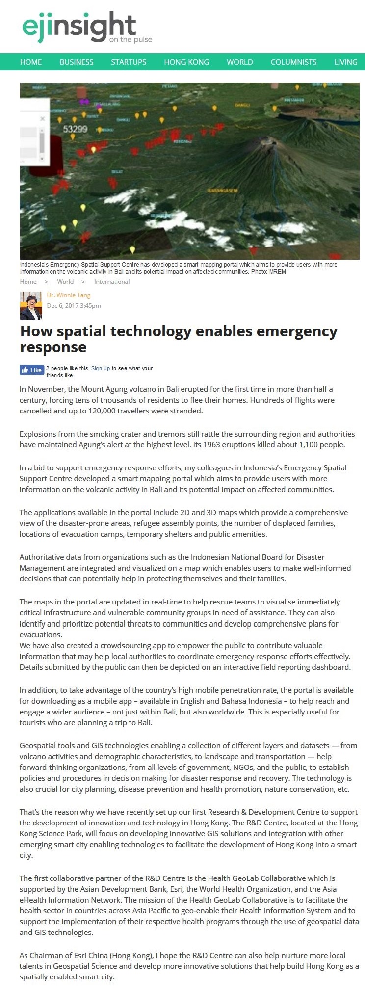
In a bid to support emergency response efforts, my colleagues in Indonesia's Emergency Spatial Support Centre developed a smart mapping portal which aims to provide users with more information on the volcanic activity in Bali and its potential impact on affected communities.
The applications available in the portal include 2D and 3D maps which provide a comprehensive view of the disaster-prone areas, refugee assembly points, the number of displaced families, locations of evacuation camps, temporary shelters and public amenities.
Authoritative data from organizations such as the Indonesian National Board for Disaster Management are integrated and visualized on a map which enables users to make well-informed decisions that can potentially help in protecting themselves and their families.
The maps in the portal are updated in real-time to help rescue teams to visualise immediately critical infrastructure and vulnerable community groups in need of assistance. They can also identify and prioritize potential threats to communities and develop comprehensive plans for evacuations.
We have also created a crowdsourcing app to empower the public to contribute valuable information that may help local authorities to coordinate emergency response efforts effectively. Details submitted by the public can then be depicted on an interactive field reporting dashboard.
In addition, to take advantage of the country's high mobile penetration rate, the portal is available for downloading as a mobile app – available in English and Bahasa Indonesia – to help reach and engage a wider audience – not just within Bali, but also worldwide. This is especially useful for tourists who are planning a trip to Bali.
Geospatial tools and GIS technologies enabling a collection of different layers and datasets — from volcano activities and demographic characteristics, to landscape and transportation — help forward-thinking organizations, from all levels of government, NGOs, and the public, to establish policies and procedures in decision making for disaster response and recovery. The technology is also crucial for city planning, disease prevention and health promotion, nature conservation, etc.
That's the reason why we have recently set up our first Research & Development Centre to support the development of innovation and technology in Hong Kong. The R&D Centre, located at the Hong Kong Science Park, will focus on developing innovative GIS solutions and integration with other emerging smart city enabling technologies to facilitate the development of Hong Kong into a smart city.
The first collaborative partner of the R&D Centre is the Health GeoLab Collaborative which is supported by the Asian Development Bank, Esri, the World Health Organization, and the Asia eHealth Information Network. The mission of the Health GeoLab Collaborative is to facilitate the health sector in countries across Asia Pacific to geo-enable their Health Information System and to support the implementation of their respective health programs through the use of geospatial data and GIS technologies.
As Chairman of Esri China (Hong Kong), I hope the R&D Centre can also help nurture more local talents in Geospatial Science and develop more innovative solutions that help build Hong Kong as a spatially enabled smart city.
Dr. Winnie Tang
Honorary Professor, Department of Computer Science, The University of Hong Kong