網上版請按此
The history and culture behind the hidden beauty of South Lantau
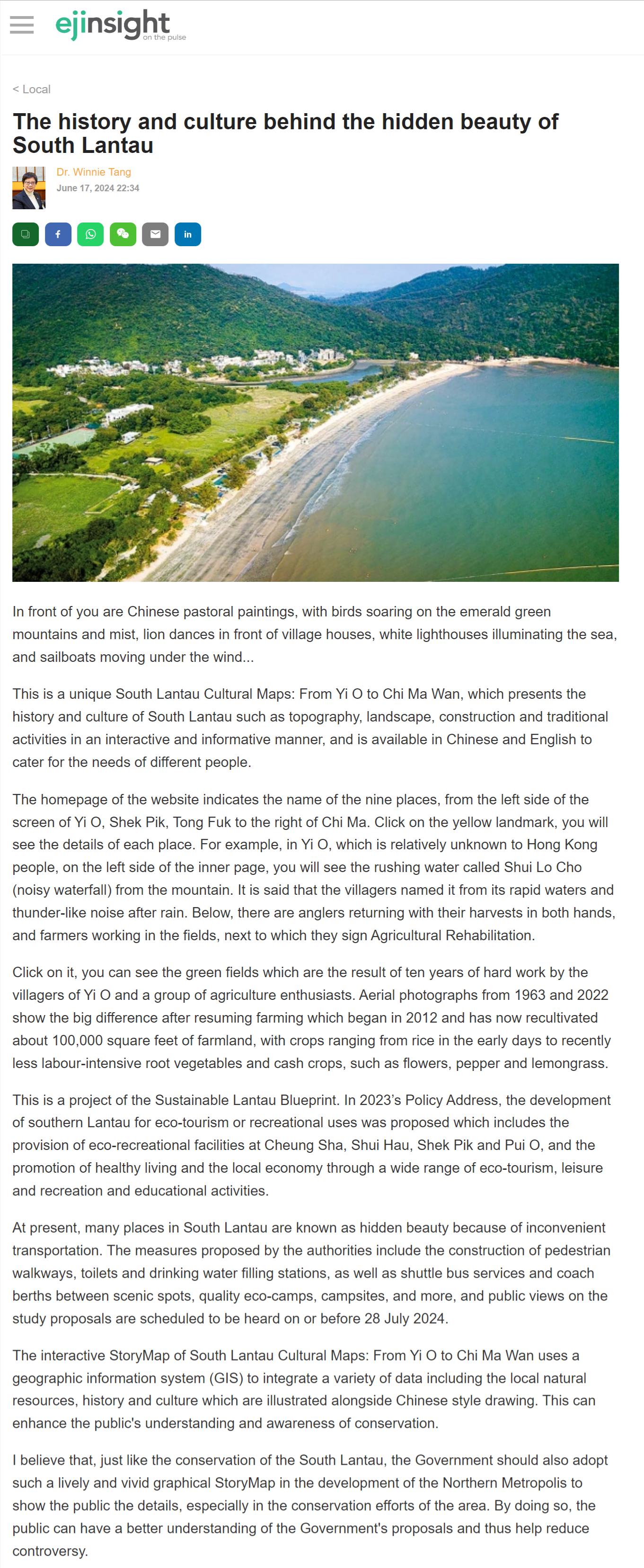
In front of you are Chinese pastoral paintings, with birds soaring on the emerald green mountains and mist, lion dances in front of village houses, white lighthouses illuminating the sea, and sailboats moving under the wind...
This is a unique South Lantau Cultural Maps: From Yi O to Chi Ma Wan, which presents the history and culture of South Lantau such as topography, landscape, construction and traditional activities in an interactive and informative manner, and is available in Chinese and English to cater for the needs of different people.
The homepage of the website indicates the name of the nine places, from the left side of the screen of Yi O, Shek Pik, Tong Fuk to the right of Chi Ma. Click on the yellow landmark, you will see the details of each place. For example, in Yi O, which is relatively unknown to Hong Kong people, on the left side of the inner page, you will see the rushing water called Shui Lo Cho (noisy waterfall) from the mountain. It is said that the villagers named it from its rapid waters and thunder-like noise after rain. Below, there are anglers returning with their harvests in both hands, and farmers working in the fields, next to which they sign Agricultural Rehabilitation.
Click on it, you can see the green fields which are the result of ten years of hard work by the villagers of Yi O and a group of agriculture enthusiasts. Aerial photographs from 1963 and 2022 show the big difference after resuming farming which began in 2012 and has now recultivated about 100,000 square feet of farmland, with crops ranging from rice in the early days to recently less labour-intensive root vegetables and cash crops, such as flowers, pepper and lemongrass.
This is a project of the Sustainable Lantau Blueprint. In 2023's Policy Address, the development of southern Lantau for eco-tourism or recreational uses was proposed which includes the provision of eco-recreational facilities at Cheung Sha, Shui Hau, Shek Pik and Pui O, and the promotion of healthy living and the local economy through a wide range of eco-tourism, leisure and recreation and educational activities.
At present, many places in South Lantau are known as hidden beauty because of inconvenient transportation. The measures proposed by the authorities include the construction of pedestrian walkways, toilets and drinking water filling stations, as well as shuttle bus services and coach berths between scenic spots, quality eco-camps, campsites, and more, and public views on the study proposals are scheduled to be heard on or before 28 July 2024.
The interactive StoryMap of South Lantau Cultural Maps: From Yi O to Chi Ma Wan uses a geographic information system (GIS) to integrate a variety of data including the local natural resources, history and culture which are illustrated alongside Chinese style drawing. This can enhance the public's understanding and awareness of conservation.
I believe that, just like the conservation of the South Lantau, the Government should also adopt such a lively and vivid graphical StoryMap in the development of the Northern Metropolis to show the public the details, especially in the conservation efforts of the area. By doing so, the public can have a better understanding of the Government's proposals and thus help reduce controversy.
Dr. Winnie Tang
Adjunct Professor, Department of Computer Science, Faculty of Engineering; Department of Geography, Faculty of Social Sciences; and Faculty of Architecture, The University of Hong Kong