網上版請按此
Balance between conservation and development of South Lantau
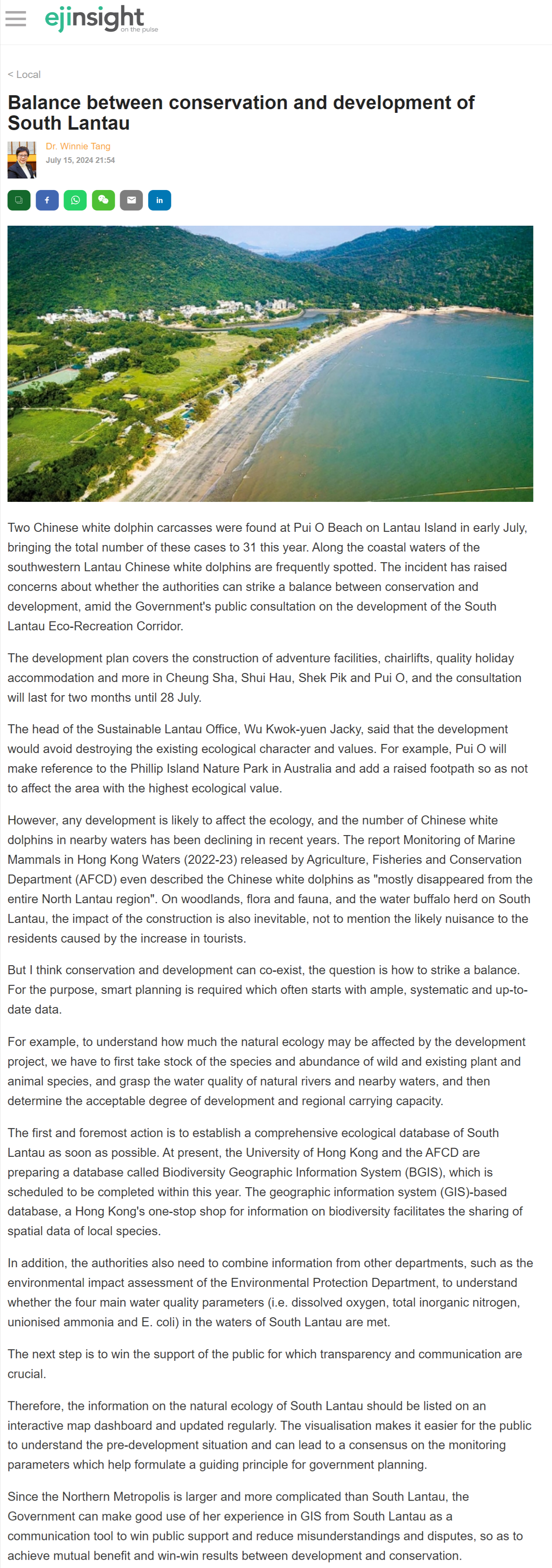
Two Chinese white dolphin carcasses were found at Pui O Beach on Lantau Island in early July, bringing the total number of these cases to 31 this year. Along the coastal waters of the southwestern Lantau Chinese white dolphins are frequently spotted. The incident has raised concerns about whether the authorities can strike a balance between conservation and development, amid the Government's public consultation on the development of the South Lantau Eco-Recreation Corridor.
The development plan covers the construction of adventure facilities, chairlifts, quality holiday accommodation and more in Cheung Sha, Shui Hau, Shek Pik and Pui O, and the consultation will last for two months until 28 July.
The head of the Sustainable Lantau Office, Wu Kwok-yuen Jacky, said that the development would avoid destroying the existing ecological character and values. For example, Pui O will make reference to the Phillip Island Nature Park in Australia and add a raised footpath so as not to affect the area with the highest ecological value.
However, any development is likely to affect the ecology, and the number of Chinese white dolphins in nearby waters has been declining in recent years. The report Monitoring of Marine Mammals in Hong Kong Waters (2022-23) released by Agriculture, Fisheries and Conservation Department (AFCD) even described the Chinese white dolphins as "mostly disappeared from the entire North Lantau region". On woodlands, flora and fauna, and the water buffalo herd on South Lantau, the impact of the construction is also inevitable, not to mention the likely nuisance to the residents caused by the increase in tourists.
But I think conservation and development can co-exist, the question is how to strike a balance. For the purpose, smart planning is required which often starts with ample, systematic and up-to-date data.
For example, to understand how much the natural ecology may be affected by the development project, we have to first take stock of the species and abundance of wild and existing plant and animal species, and grasp the water quality of natural rivers and nearby waters, and then determine the acceptable degree of development and regional carrying capacity.
The first and foremost action is to establish a comprehensive ecological database of South Lantau as soon as possible. At present, the University of Hong Kong and the AFCD are preparing a database called Biodiversity Geographic Information System (BGIS), which is scheduled to be completed within this year. The geographic information system (GIS)-based database, a Hong Kong's one-stop shop for information on biodiversity facilitates the sharing of spatial data of local species.
In addition, the authorities also need to combine information from other departments, such as the environmental impact assessment of the Environmental Protection Department, to understand whether the four main water quality parameters (i.e. dissolved oxygen, total inorganic nitrogen, unionised ammonia and E. coli) in the waters of South Lantau are met.
The next step is to win the support of the public for which transparency and communication are crucial.
Therefore, the information on the natural ecology of South Lantau should be listed on an interactive map dashboard and updated regularly. The visualisation makes it easier for the public to understand the pre-development situation and can lead to a consensus on the monitoring parameters which help formulate a guiding principle for government planning.
Since the Northern Metropolis is larger and more complicated than South Lantau, the Government can make good use of her experience in GIS from South Lantau as a communication tool to win public support and reduce misunderstandings and disputes, so as to achieve mutual benefit and win-win results between development and conservation.
Dr. Winnie Tang
Adjunct Professor, Department of Computer Science, Faculty of Engineering; Department of Geography, Faculty of Social Sciences; and Faculty of Architecture, The University of Hong Kong